Water Cycle Diagram Generator
Free online Water Cycle Diagram generator: get a fully labeled figure in about 90 seconds. The AI plans the must-have label list first, then renders a clean textbook-style diagram — every label editable afterwards, ready for papers, assignments and slides.
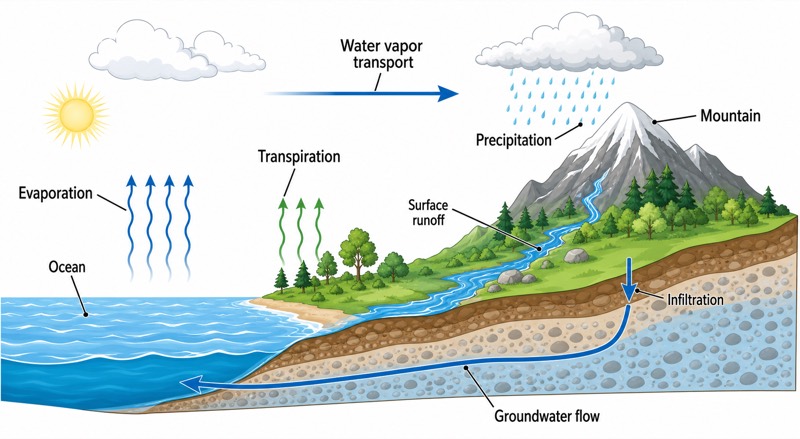
Labels included in this diagram
- Evaporation
- Transpiration
- Water vapor transport
- Precipitation
- Surface runoff
- Infiltration
- Groundwater flow
- Ocean
- Mountain
✓ Accurate labels ✓ Edit text after generation ✓ PNG for papers, posters & slides
 OUTPUT · 16:9 · PNG
What this diagram shows
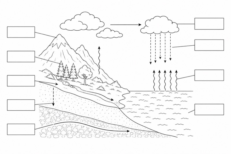
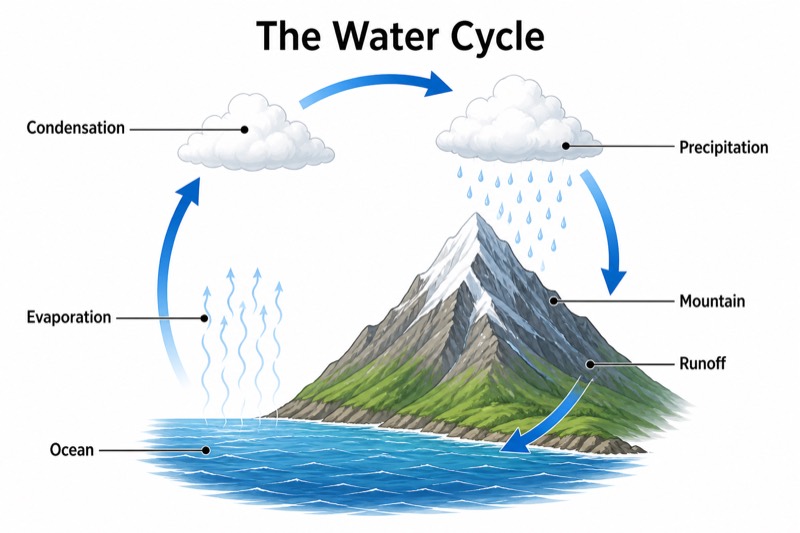
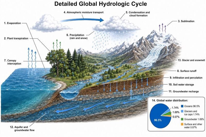
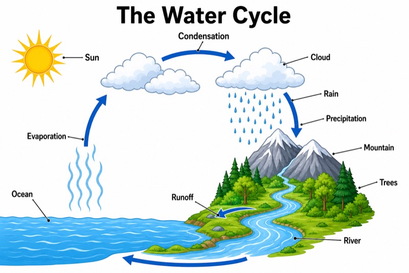
A Water Cycle Diagram shows how water continuously moves among the ocean, atmosphere, land, plants, and underground layers. Solar energy causes evaporation from the ocean and other surface water, while plants release water vapor through transpiration. The vapor rises, cools, and condenses to form clouds. Water vapor transport moves moist air toward land and mountains. When water droplets or ice crystals become heavy enough, precipitation falls as rain, snow, sleet, or hail. The diagram also presents the ocean as a major water store and mountains as important areas where air rises, cools, and often produces precipitation.
After precipitation reaches the ground, water follows several connected pathways. Some flows downhill as surface runoff, entering streams, rivers, lakes, and eventually the ocean. Some soaks into the soil through infiltration and may move deeper to recharge groundwater. Groundwater flow slowly carries underground water toward springs, rivers, or the ocean. Plants absorb part of the soil water and return it to the atmosphere by transpiration. Arrows should show that solar energy drives evaporation and transpiration, while gravity drives precipitation, runoff, infiltration, and groundwater flow. The processes form a continuous cycle rather than a simple sequence with a fixed beginning or end.
What a correct diagram must include
- Ocean and land stores: Draw the ocean beside a land area and mountain to show where water is stored and exchanged.
- Evaporation: Add upward arrows from the ocean or other surface water because solar energy changes liquid water into water vapor.
- Transpiration: Draw upward arrows from plant leaves to show water vapor released by plants.
- Condensation and clouds: Place clouds above the landscape because cooling water vapor condenses into tiny liquid droplets or ice crystals.
- Water vapor transport: Use horizontal arrows in the atmosphere to show wind carrying moist air from the ocean toward land and mountains.
- Precipitation: Draw downward arrows from clouds and label rain or snow to show water returning from the atmosphere to Earth's surface.
- Surface runoff and infiltration: Show water flowing downhill toward rivers and the ocean, while separate downward arrows indicate water entering the soil.
- Groundwater flow: Add a subsurface water layer with arrows moving toward rivers or the ocean to show the slow movement of groundwater.
Common mistakes
- Drawing evaporation as liquid water rising in drops instead of showing invisible water vapor moving upward from a water surface.
- Confusing transpiration with evaporation by placing transpiration arrows over bare soil rather than showing vapor released from plant leaves.
- Showing precipitation before condensation, even though clouds form when water vapor cools and condenses.
- Drawing all precipitation as surface runoff and ignoring infiltration, soil water, and groundwater flow.
- Pointing groundwater arrows uphill or directly upward without a spring; groundwater generally moves slowly from higher hydraulic levels toward lower areas.
Teaching tips
Use the diagram after introducing changes of state or as a review before an assessment. Ask students to trace one water molecule from the ocean to a cloud, mountain, river, groundwater, and back to the ocean. Questions such as “Which processes are driven by solar energy?” and “Which movements are controlled mainly by gravity?” connect the image to common test points. Students can also classify each label as atmospheric, surface, biological, or underground and explain how evaporation differs from transpiration, and how surface runoff differs from groundwater flow.
FAQ about this diagram
Does the water cycle have a fixed starting point?
No. Water is stored and moved continuously among the ocean, atmosphere, land, organisms, and underground layers. A diagram often begins with evaporation for convenience, but any storage or process can be used as the starting point.
What is the difference between surface runoff and groundwater flow?
Surface runoff moves over the land into streams, rivers, lakes, or the ocean. Groundwater flow occurs below the surface after infiltration and usually moves much more slowly through pores and cracks in soil and rock.
Why do mountains often receive more precipitation?
Mountains force moist air to rise. As the air rises, it expands and cools, causing water vapor to condense into clouds and often produce precipitation on the windward side.